First Accumulating Snowfall of Season Possible For High Elevations of WNC
And so it begins! The first winter threat of the season will be possible early Tuesday morning above 4500’ in WNC. A strong front will move through and temperatures will plummet into the upper 20’s even in the valleys around Asheville. This will be our first hard freeze of the season, and should effectively halt anything growing that needs temps to stay above freezing. Below you can see the most recent NAM 3km model and where it shows the accumulation of snow early Tuesday morning.
Courtesy of Weathermodels.com
How Cold Will It Get Around WNC?
After the front moves through Monday afternoon, temperatures will plummet. Many locations by early Thursday morning could be as low as 25 degrees! Below you can see the most recent NAM 3km and what it shows regarding low temperatures for your area on Tuesday AM. This will certainly be a shock to the system! Its time to pull out that heavy jacket and get prepared! This will also accelerate the leaf change around WNC. Peak week will likely be this week for most locations.
Nam3km Temps Tuesday Morning Courtesy of Weathermodels.com
Contact my local trusted roofing source Matt at RedWolf Contracting Services to take care of all of your roof replacements. From shingles, to metal roofing, and even commercial rubber membrane, Matt has the resources and solutions to take care of your job in a professional and cost effective manner. Call (828) 772-9778 or visit nc-roofers.com to set up your free roof inspection.
Fall Color Effects
Fall color will likely peak this week and into next weekend around WNC as temperatures drop below freezing for several mornings. In fact, Wednesday morning looks even colder than Tuesday as you can see on the GFS below. It drops temps to 25 degrees! So around a week ahead here in WNC, I look for peak leaves during this week and then finishing up next weekend!
GFS Wednesday AM Cold Courtesy of Weathermodels.com
Below Average Temps Expected All Week
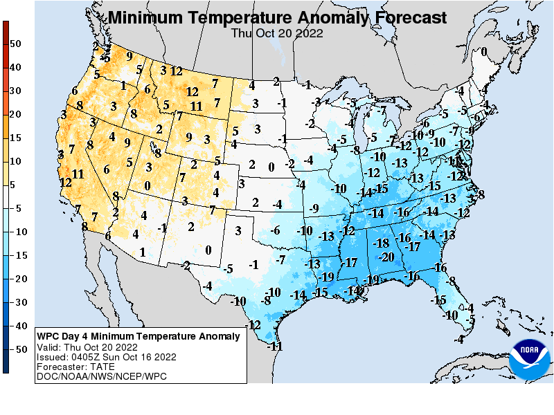
Temperatures will likely be well below average this week around WNC as we get our first taste of Winter! Below you can see the departure from average that we will see mid week for temperatures. Enjoy the cool weather! we look to return to somewhat normal temps next week!
Courtesy of WPC


