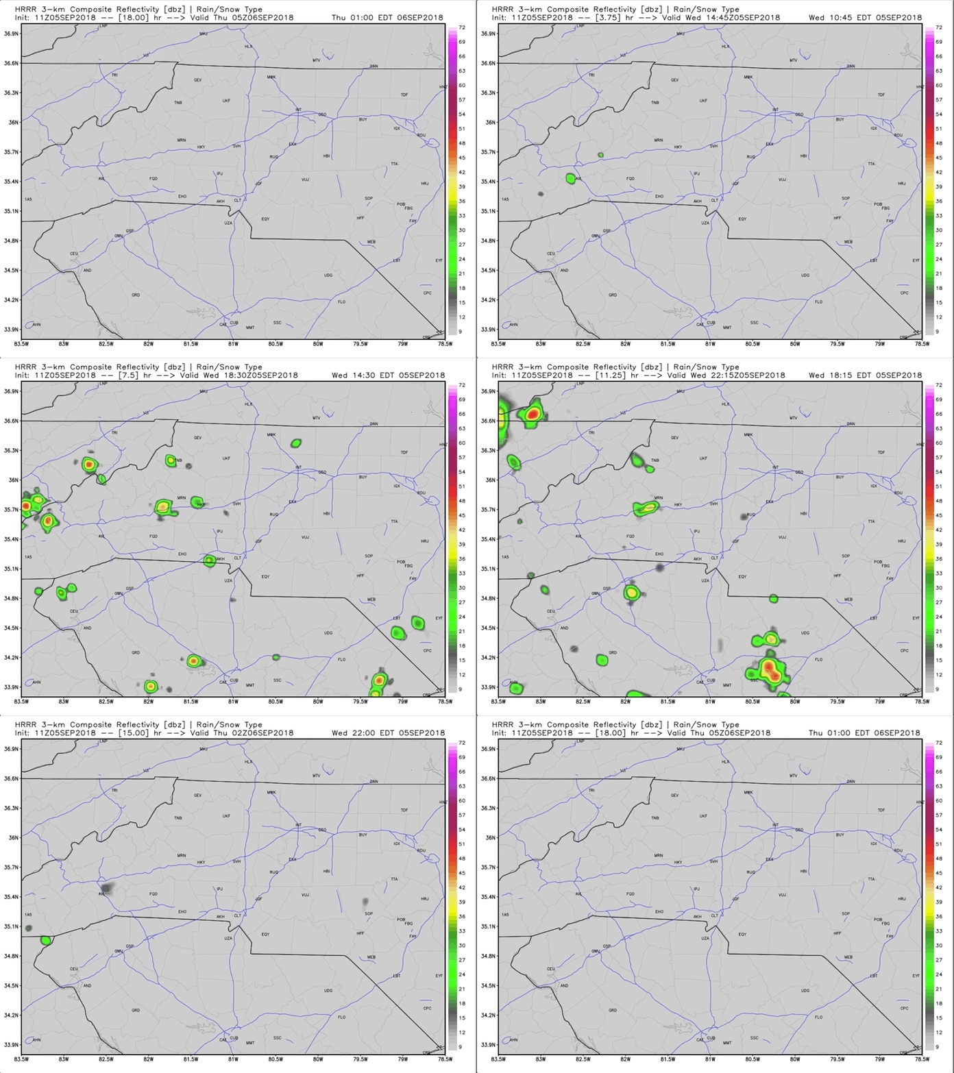
Pop-Up Thunderstorms are possible this afternoon for many locations around WNC as daytime heating ignites a few updrafts. Some of these cells could go severe, with gusty winds, and isolated hail. Below is a radar simulation from the most recent (11z) HRRR run. You can see that will ample humidity at the surface, various storms develop and move to the Northwest. These cells do not appear to be long lived, but some locations could see rainfall rates of over 1" per hour.
Frequent lightning will also be possible as these cells first develop. Please move indoors when thunder roars. The majority of these cells will dissipate as the sun sets, but I cannot rule out a few nocturnal storms developing off of a stray outflow boundary late this evening.
Looking forward, The GFS shows humidity levels relaxing somewhat tomorrow, and that will help to keep storm development at bay. Humidity levels will also be lower on Friday, which should make for a more comfortable afternoon. Greater thunderstorm chances will return on Saturday, as we finally experience a bit of influence from former Tropical Storm Gordon. Both Saturday and Sunday look to be extremely muggy as a front associated with Gordon moves through. Storm development will be possible throughout the day on Saturday and Sunday, so make outdoor plans tentatively.
Sept 5th 6z GFS Run Showing Precipitation Amounts Saturday Night
Muggy conditions will continue through early next week, when all eyes will begin to turn to Hurricane Florence. There is still GREAT uncertainty as to how or even if this storm will affect this US, but it is something to watch since some long range models have hinted at that possibility. As of the most recent 0z Euro run and 6z GFS run, both models have a tropical system dangerously close to the East Coast late next week. THESE WILL CHANGE THOUGH. All that should be taken from these model runs, is that the atmosphere is very supportive of strong tropical development, and there is a chance that an Easterly Wave could enter the area, and cause problems. Each model run will vary greatly, and Florence could very well stay out to sea, so stay tuned to see how this unfolds!


