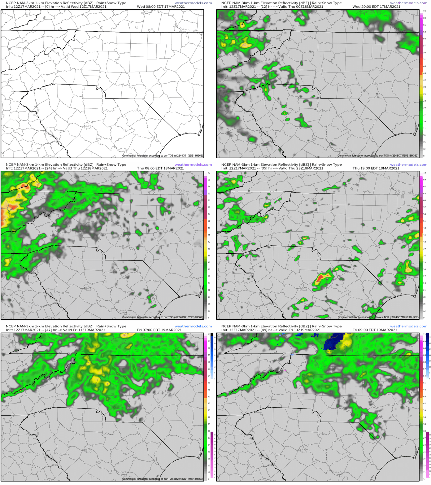
A stout line of storms will move through the mountains of WNC Thursday morning around 8-11am. This will bring with it the chance for damaging wind gusts, and isolated hail throughout the area. While many others around the Southeast will experience a heightened tornado threat, timing and terrain here in the mountains of WNC will limit the immediate threat for tornados in our area. Though a spin-up cannot be ruled out from this system, they are unlikely. Below you can see the progression from the most recent NAM 3km.
Contact my local trusted roofing source Matt at RedWolf Contracting Services to take care of all of your roof replacements. From shingles, to metal roofing, and even commercial rubber membrane, Matt has the resources and solutions to take care of your job in a professional and cost effective manner. Call (828) 772-9778 or visit nc-roofers.com to set up your free roof inspection.
We're here to help reduce the use of single-use plastics by offering bulk refills of household needs. Come refill your empty containers (shampoo bottles, hand soap dispensers, laundry detergent containers, jars etc) with our more natural products and pay by the ounce! To The Brim Click Here
Timing For WNC?
Looking below at the most recent overview chart from the HRRR model run and you can see that scattered storms are expected to move in late this evening, but the main line of storms will move through between 8am-11am tomorrow for WNC. Storm development during this time frame will be less explosive compared to if this line was moving through during the afternoon hours, so that will likely keep some of damaging wind threat at bay.
HRRR Courtesy of Weathermodels.com
The trusted local accounting firm for WNC, let the team of Adrianne, Caroyl, & Naomi take care of all of your tax needs. Whether you need payroll/business accounting help or assistance filing your personal taxes, these ladies are the experts to put your trust with. Give them a call (828) 684-7374 or visit their website http://www.kruseaccounting.com to set up your appointment today!
Increased Threat For Tornados Across South Today & Tomorrow
As you can see on the first image in this article, there is a severe weather threat for the majority of NC, SC, & GA tomorrow… but today a high risk for tornados and severe weather exists across Mississippi. This threat will also extend to Alabama, Arkansas, & Tennessee, as well as Louisiana. It could be a day that goes down in history. Check out the SPC forecast for today below. Please keep these people in your thoughts and prayers.
Live Update Tonight at 5pm
Join me live on Facebook tonight as I discuss the severe weather that is impending for WNC. I will also cover the ongoing tornado threat across the Southeast! See you then!


