Tropical moisture is on the horizon for WNC as we progress into Hurricane Season. A large push of moisture that will be associated with Tropical Depression Fred as we move into next week could cause flash flooding in many areas. There are varying solutions as to how strong Fred will become in the Gulf, but the heavy rainfall appears imminent. Below you can see the most recent European Model tracks for the 6z Spaghetti Model run.
Fred Projected Tracks From European Model Courtesy of Weathermodels.com
How Much Rainfall is Possible?
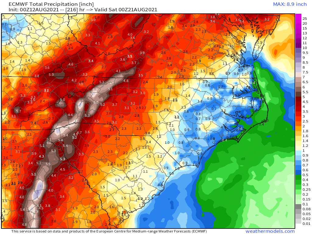
There is a wide range of totals showing up on current model projections for WNC. Currently the GFS(seen below) shows only 2”-3” of rainfall for most, whereas the European models shows much higher totals of 4”-6” of rainfall with spots over 8”. These tropical systems can be very hard to model, but one thing is becoming more and more clear and that is the fact that heavy moisture is on the way for early next week.
GFS Rainfall Totals Courtesy of Weathermodels.com
Contact my local trusted roofing source Matt at RedWolf Contracting Services to take care of all of your roof replacements. From shingles, to metal roofing, and even commercial rubber membrane, Matt has the resources and solutions to take care of your job in a professional and cost effective manner. Call (828) 772-9778 or visit nc-roofers.com to set up your free roof inspection.
Euro Rainfall Totals Through Next Week Courtesy of Weathermodels.com
How Strong Will Fred Get?
Most models show Fred being a big time rain maker and a limited wind threat. That could change, but check out this chart from Tropicaltidbits.com that shows each models peak intensity. This could change, but I am not expecting a high impact wind event for WNC from this system. The main threat will be flooding.
Intensity forecast courtesy of Tropicaltidbits.com
More Data To Come
Ill have more articles and even a live update if necessary to get you prepared for this rainfall. Timing for the heaviest rainfall appears to be on Tuesday and into Wednesday so it would be wise now to begin to prepare around that time frame. Check back soon for more information!


