Fall Feel Exits WNC As September Heat Wave Sets In
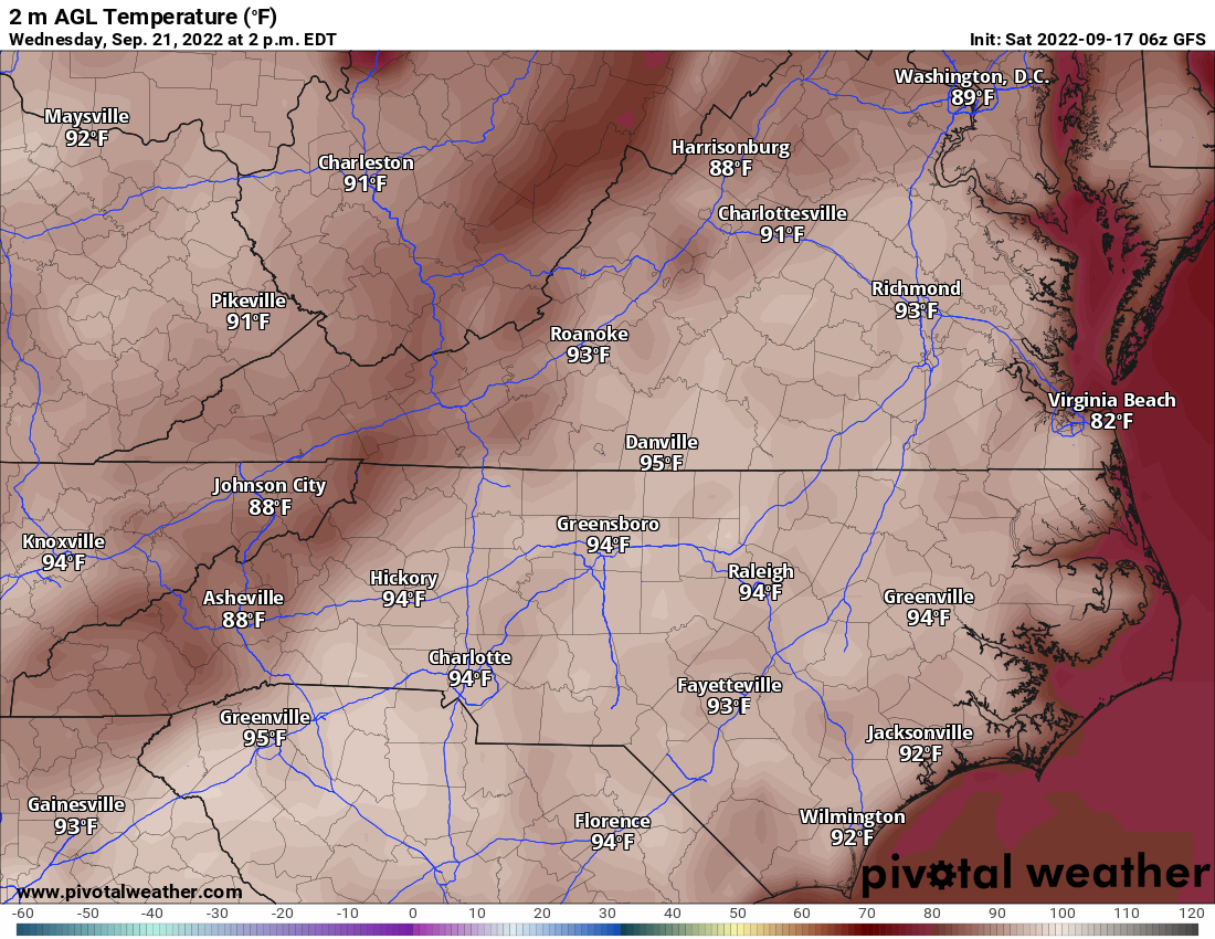
Have you been enjoying the cool fall temperatures this week? Well do not get used to it because the high 80’s and 90’s will return to WNC mid next week. Both the GFS and European models have been hinting at near 90 degree temperatures around WNC by Wednesday. Check out the GFS below, these are the high temps projected for Wednesday afternoon.
GFS Image Courtesy of Pivotalweather.com
How Long Will The Heat Persist?
It appears as thought we are in for a somewhat long duration heat wave. I expect at least a week of these temperature in the mid to upper 80’s before a cool off is expected late next weekend. There is still some uncertainty to this cool down, but both the GFS and European models have the signal I look for in the long range. Moving forward, I suspect that by next Monday we will be making a much more abrupt enterance to fall that is somewhat sustained. So with that being said, hopefully this is the last time in 2022 that we will be treating the 90 degree temp level. For those of you above 3500’, you will likely barely get into the 80’s so the refresh will continue for your location. Check out the most recent long range GFS, it shows temps on Monday of the following week in the upper 40’s to start the day. Ill keep an eye on this and update you about the progression!
Contact my local trusted roofing source Matt at RedWolf Contracting Services to take care of all of your roof replacements. From shingles, to metal roofing, and even commercial rubber membrane, Matt has the resources and solutions to take care of your job in a professional and cost effective manner. Call (828) 772-9778 or visit nc-roofers.com to set up your free roof inspection.
GFS Temps Provided By Pivotalweather.com


