

The moisture will continue to move in from the South & West as a persistent flow continues to dominate. This has been the theme for the past several months and that pattern looks to continue at least for the next ten days with no significant high pressures building to our south or east. Rainfall this week though will be somewhat light for the most part around WNC with under an inch expected in many locations through Friday. Below you can see the most recent GFS precipitation totals through Friday pm around WNC.
GFS Precip Courtesy of Weathermodels.com

Contact my local trusted roofing source Matt at RedWolf Contracting Services to take care of all of your roof replacements. From shingles, to metal roofing, and even commercial rubber membrane, Matt has the resources and solutions to take care of your job in a professional and cost effective manner. Call (828) 772-9778 or visit nc-roofers.com to set up your free roof inspection.
Now let’s contrast that with what the European model is showing regarding total precipitation through the end of the week, and one can see that both models are very similar, and neither is really showing much of a washout.
Euro precip totals through Friday pm Courtesy of Weathermodels.com

For the finest landscaping in Western North Carolina, contact Sam Byrnside of L & S Landscape for a free estimate. From planting to mowing, mulching and all landscaping necessities in between contact Sam & his team! L & S also does salting of roads & driveways during the winter as well as tow pull outs if you get stuck in bad weather! Just give Sam a call (828)329-6020 to schedule your appointment today! Visit Site
Scattered Showers No Real Wash Out
Monday (Today) appears to be the driest of days with only limited shower activity expected. Then as we progress through the days of Tuesday, Wednesday, & Thursday, weak pieces of energy traverse the mountains each day. There is no real dominate area of low pressure that pushes through, but with each small system will bring a new chance of rain each day. So to put it plainly, it’s going to be pretty nasty around WNC this week. Below you can see how the GFS depicts this week unfolding. Notice the various waves that move through each day. This is another recipe for soggy conditions around the area unfortunately.
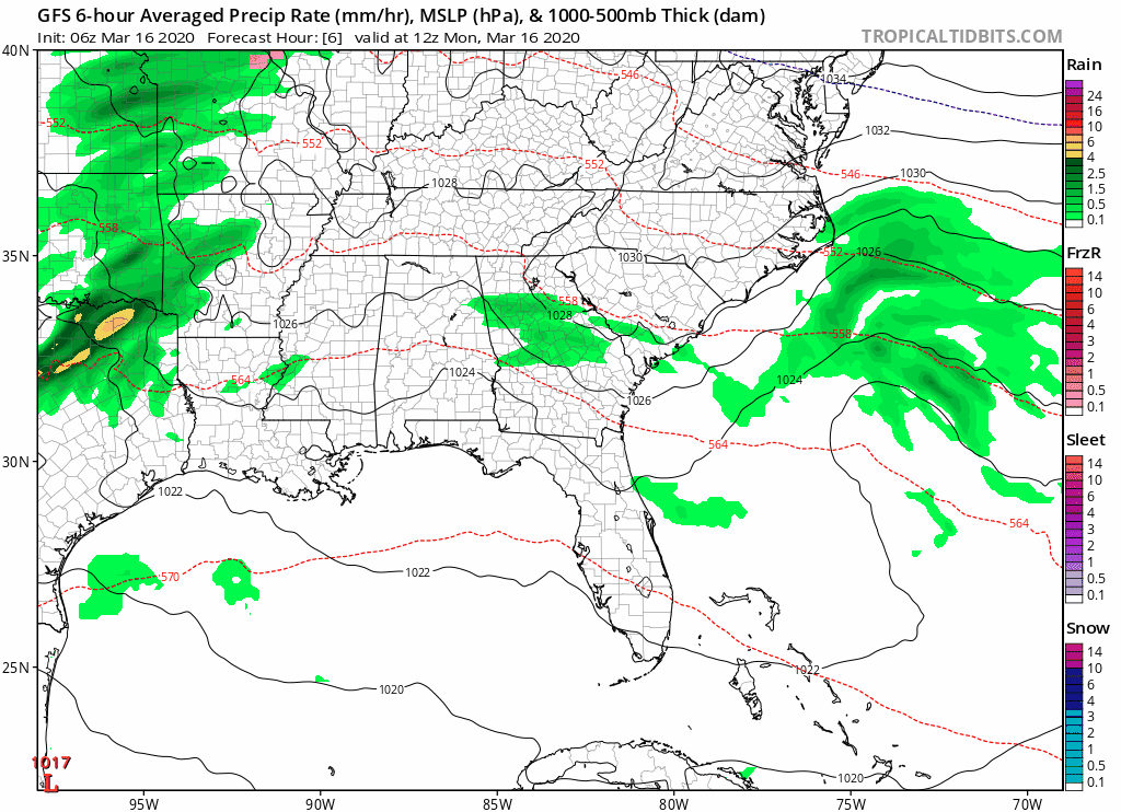
GFS courtesy of Tropicaltidbits.com

Come to where Mother Nature waved her magic wand and created one of the most natural of all wonders, Natural Hot Mineral Waters. Heated deep within the earth, these crystal clear carbonated waters are are world famous for their mineral content and legendary healing powers. We pipe these waters to modern outdoor jetted hot tubs that we rent privately by the hour. In addition to our World Famous Natural Hot Mineral baths the day spa offers massage, body treatments, and skin care options. Hot Springs Resort also offers accommodations and camping options. Please visit http://www.nchotsprings.com for more information.
Cold Returns This Weekend With Great Uncertainty
Looking ahead to the weather for this weekend, most models indicated that another round of rainfall will be likely on Saturday for most. Then a massive high pressure will move in and drop temperatures close to freezing on both Sunday and Monday of next week. Some models have some form of precipitation moving in, but as of now there is still great uncertainty. What I am focusing on currently is that a large high pressure will be in place with overrunning precipitation moving in from the Southwest. For WNC, we can still receive wintry weather into early April… but ground temps and sun angle become huge regarding the affects. So, main takeaway here is that I have my eye on a system that will move in late next weekend and will need more information to make an accurate forecast. Below you can see what each model is showing in the long range.
The trusted local accounting firm for WNC, let the team of Adrianne, Caroyl, & Naomi take care of all of your tax needs. Whether you need payroll/business accounting help or assistance filing your personal taxes, these ladies are the experts to put your trust with. Give them a call (828) 684-7374 or visit their website http://www.kruseaccounting.com to set up your appointment today!
GFS Depiction Courtesy of Tropicaltidbits.com
Euro Courtesy of Pivotalweather.com

Call the team that keeps my truck clean at A&R Specialist! David, Matt & Harley run A&R Specialist at 621 Brevard Rd. and they are the guys to trust with your vehicle cleaning & detailing. Whether you need a deep wax every once in a while or a quality clean and detail, you can feel safe putting your car in the hands of A&R Specialist! Call (828) 708-3718 to set up your appointment today. https://www.facebook.com/ARpressurewashing4/
GEM (Canadian Model) Precipitation Depiction Courtesy of Tropicaltidbits.com
More information will be needed to nail down the forecast for late Sunday and into early next week, but check back soon for more updates and check social media for live tidbits and more information!


