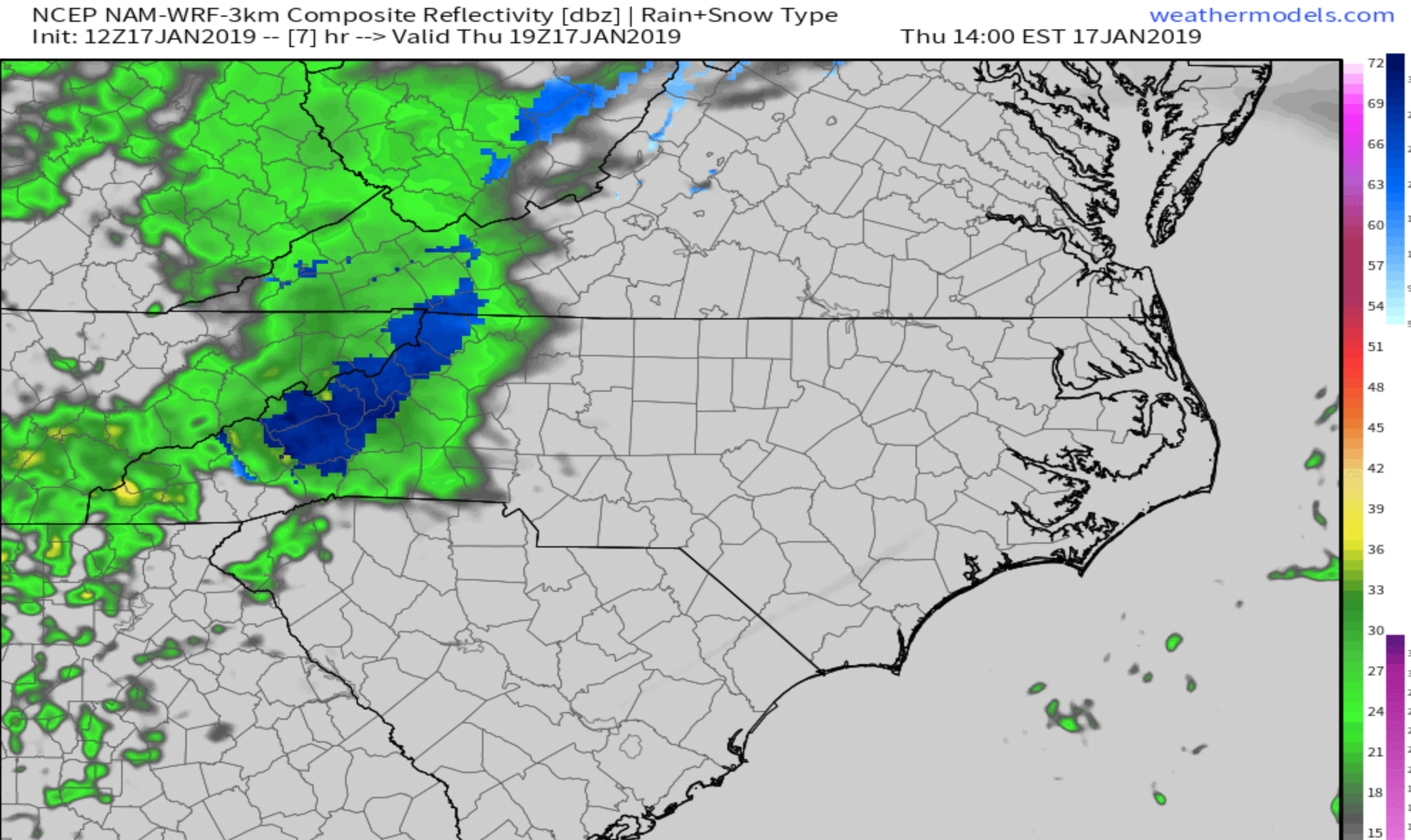
The most recent run of the Nam 3km indicates that a switch from rain to snow will be possible this afternoon as precipitation becomes heavy around WNC. This switchover will not occur everywhere, but some locations that do switch to snow could see a dusting to 1” of accumulation. Below you can see the most recent precipitation depiction map for 2-3pm this afternoon. It shows a heavy band of precipitation (that you can currently see in Eastern Tennessee) moving through WNC and switching to snow for some locations.
12z 3km Nam Precipitation Depiction Courtesy of Weathermodels.com
Trust The Tax Pros
It’s time to get your taxes done again this year, so why not let the local pros at C.P. Kruse handle the hassle for you? Call them at (828) 684-7374 or visit their website http://www.kruseaccounting.com
Here is the total snowfall map that the 3km nam produced. I expect precipitation to begin to move in over the next hour or so, and a switch could occur around 2pm-3pm. This map shows a widespread dusting. This indeed is possible, and if heavy snow were to fall for an hour or so, a dusting to 1” would be the result. Be sure to report what you are seeing to the AshevilleWX Weather Community on Facebook!
12z 3km NAM Snowfall Totals Courtesy of Weathermodels.com
Watch The Snow Fall
Check in with the AshevilleWX HD Live Webcams this afternoon to see where the snow is falling! You can find them here:
Grimes Teich Anderson LLP Downtown Asheville Camera
Henco Reprographics Candler/Mt. Pisgah Camera
Olivette Riverside Farm Community Alexander, NC Camera
Haywood County Farm Bureau Insurance Canton/Dutch Cove Camera


