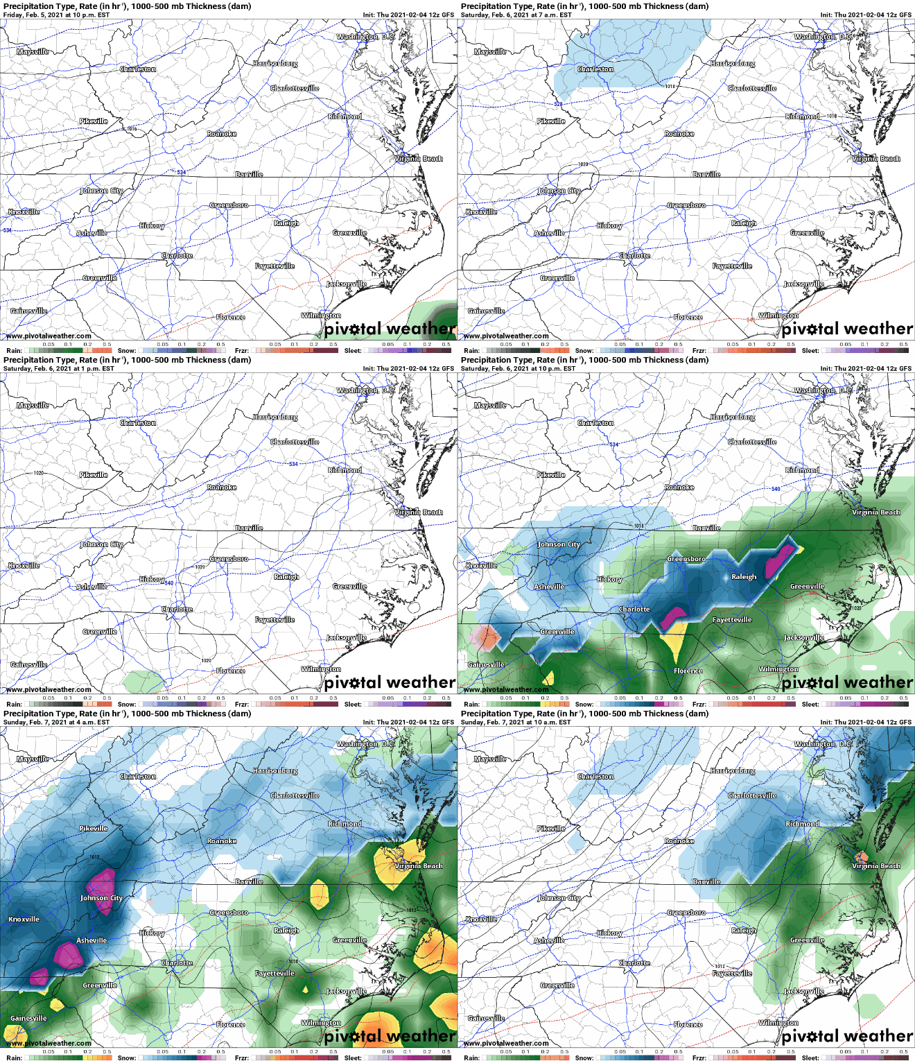
An overrunning precipitation event will likely occur this weekend around WNC where cold temperatures will be in place. Moisture will begin to stream into WNC Saturday afternoon for the SW and will run into a frozen column of air. Snowfall will begin for many as the afternoon progresses and more moisture begins to move in. Models are really just now getting a grip on this solution, so some caution is to be had here but I will do my best to walk you through the possible scenarios.
The trusted local accounting firm for WNC, let the team of Adrianne, Caroyl, & Naomi take care of all of your tax needs. Whether you need payroll/business accounting help or assistance filing your personal taxes, these ladies are the experts to put your trust with. Give them a call (828) 684-7374 or visit their website http://www.kruseaccounting.com to set up your appointment today!
Model Data
The most recent NAM suite of models has snow beginning late in the afternoon on Saturday, and has several inches on the ground by the time midnight rolls around. Check out the most recent depiction below!
NAM Courtesy of Weathermodels.com
Come to where Mother Nature waved her magic wand and created one of the most natural of all wonders, Natural Hot Mineral Waters. Heated deep within the earth, these crystal clear carbonated waters are are world famous for their mineral content and legendary healing powers. We pipe these waters to modern outdoor jetted hot tubs that we rent privately by the hour. In addition to our World Famous Natural Hot Mineral baths the day spa offers massage, body treatments, and skin care options. Hot Springs Resort also offers accommodations and camping options. Please visit http://www.nchotsprings.com for more information.
GFS Model Data
The GFS model is showing a similar solution to the NAM with overrunning precipitation becoming predominate later in the afternoon on Saturday.
Call the team that keeps my truck clean at A&R Specialist! David, Matt & Harley run A&R Specialist at 621 Brevard Rd. and they are the guys to trust with your vehicle cleaning & detailing. Whether you need a deep wax every once in a while or a quality clean and detail, you can feel safe putting your car in the hands of A&R Specialist! Call (828) 708-3718 to set up your appointment today. https://www.facebook.com/ARSpecialistsLLC
GFS Snowfall Map
The GFS shows similar accumulation totals for WNC from this snowstorm, and the threat should really start to be taken seriously. 3”-6” of snowfall will cause problems on roadways Saturday evening. Please begin to make preparations.
GFS Snowfall Map Courtesy of Pivotalweather.com
GFS Sounding
The column of air that the GFS is showing i’m place over WNC Saturday afternoon is very cold and frozen throughout. This is very supportive of heavy wet snowfall. I believe that wet snow will be the precipitation type with this system as the evening progresses, and several inches of snowfall will be possible!
Contact my local trusted roofing source Matt at RedWolf Contracting Services to take care of all of your roof replacements. From shingles, to metal roofing, and even commercial rubber membrane, Matt has the resources and solutions to take care of your job in a professional and cost effective manner. Call (828) 772-9778 or visit nc-roofers.com to set up your free roof inspection.
How Much Snow For WNC?
A lot more information is needed to complete this forecast, but as of now I believe that a general 3”-6” could be possible around the Asheville area, and then those totals will decrease as you head SW. I will have a snowfall map out sometime early tomorrow morning.
We're here to help reduce the use of single-use plastics by offering bulk refills of household needs. Come refill your empty containers (shampoo bottles, hand soap dispensers, laundry detergent containers, jars etc) with our more natural products and pay by the ounce! To The Brim Click Here
I Will Be Out Of Town This Weekend
After tomorrow morning, I will be shutting of my devices and heading out of town for a nice, relaxing weekend. I know that many of you have come to rely on my constant updates during the storms, but this trip has been planned for a while and I am looking very much forward to it. Do not expect updates from me throughout this storm. I will make my final forecast on Friday morning, and if things changes so be it.. I hope that you all can respect my personal time. Thanks!


