A refreshing cold front is finally on the way for Western North Carolina, and temperatures Thursday and Friday morning will dip into the low 50’s and even upper 40’s in some locations! This will be such a relief for most as we have seen 6 days where we reached 90 degrees in September at the Asheville Airport.. Needless to say, it has been hot! Below you can see the most recent GFS model, and it shows temperatures in the 70’s for the high on Wednesday!
Wednesday Afternoon Temperatures Per GFS Provided By Weathermodels.com
Call the team that keeps my truck clean at A&R Specialist! David, Matt & Harley run A&R Specialist at 621 Brevard Rd. and they are the guys to trust with your vehicle cleaning & detailing. Whether you need a deep wax every once in a while or a quality clean and detail, you can feel safe putting your car in the hands of A&R Specialist! Call (828) 708-3718 to set up your appointment today. https://www.facebook.com/ARpressurewashing4/
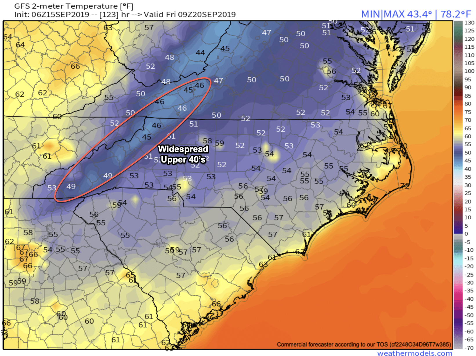
Some Locations Could See 40’s Friday AM
Some models are suggesting that upper 40’s will even be possible for a few locations on Friday morning. Below you can see the most recent GFS model, and as you can see on Friday AM many locations bottom out in the mid to upper 40’s. Boone could even get into the Mid 40’s with the GFS showing that 45 degrees will be possible!
Friday Am Temps Per 6z GFS Courtesy of Weathermodels.com
Contact my local trusted roofing source Matt at RedWolf Contracting Services to take care of all of your roof replacements. From shingles, to metal roofing, and even commercial rubber membrane, Matt has the resources and solutions to take care of your job in a professional and cost effective manner. Call (828) 772-9778 or visit nc-roofers.com to set up your free roof inspection.
How Will This Cold Front Impact Fall Color?
It should kick off the color change season across the High Country Of WNC. These low temperatures are what are needed to begin the process (which has already began in some locations), and it appears we will have 2-3 mornings of below average temperatures. So if you read my 2019 Fall Color Outlook For WNC you know that we were expecting this cold front, but how long it lasts is still up in the air. I expect to begin to see more of these cold fronts move through as we progress towards October, and as each one moves through, the fall color will enhance! Check below to see the fall color change on the AshevilleWX Live Webcams!


