
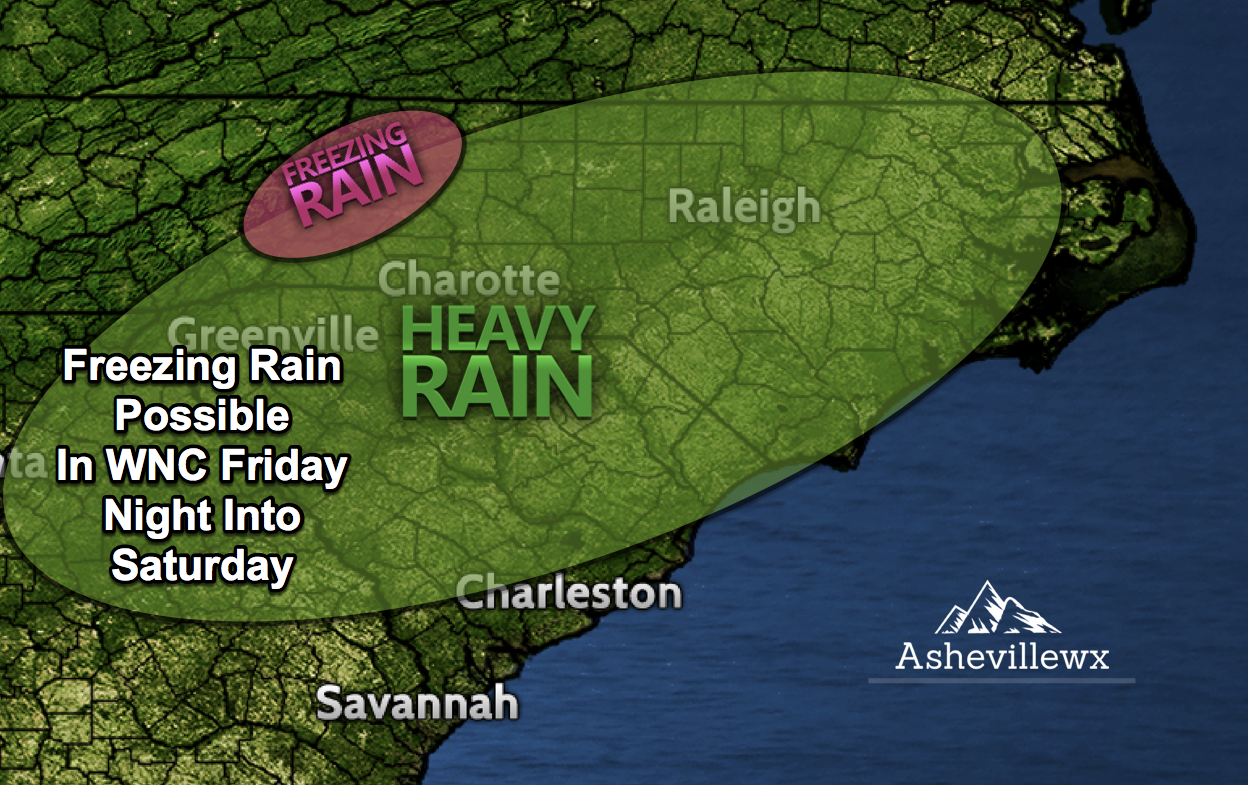
Cold Wedge Will Cause Problems Again
In a sort of rinse, wash, repeat, cycle.. it appears that another threat for ice will move into WNC early Saturday morning. Models are wavering with how strong the wedge will be, and that will affect how much cold air is allowed to spill into WNC at the surface. What does seem certain is the abundance of precipitation that is on the way.
Over 1” Of Rainfall Likely For Most Areas
Thru Saturday evening most locations will have an inch or more of rainfall in the gauge. Some of this could fall in the for of sleet or freezing rain, but with temperatures modeled to be borderline.. its difficult to make a call just yet on where frozen precipitation will fall.
Model Data
Some models indicate that surface temperatures will hoover right around freezing in the Asheville area as precipitation moves in. Similar to the event we saw last week, these cold surface temperatures eventually erode away, but it takes some duration. If the precipitation falls heavy enough initially, it can take advantage of this frozen surface layer and re-freeze. So then the precipitation becomes sleet or freezing rain. The high pressure to the north funnels in the cold air at the surface, but temperatures warm as the low pressure approaches. Depending on how strong the high pressure is, compared to how strong the low pressure is.. will determine in a sense what type of precipitation your location will see. Below you can see the most recent European model depiction. As you can see, ice will move into many areas late Friday, and persist through early Saturday morning. If you received ice from this past even, its likely that you will again receive some form of ice from this next system. Check back soon for another update as this situation unfolds.

European Radar Depiction Saturday Morning 3am

Looking To Build In WNC?
Contact Larry or Hunter Ward (828) 691-5000 to discuss building your dream home in WNC!
