

High Impact Storm In Store
A powerful low pressure will move through WNC on Sunday and into Monday bringing with it 2”-3” of much needed rain to the area, along with a chance to briefly switch over to snow on Sunday night. With such a dynamic system there are bound to be uncertainties. As of now, the one certainty is rainfall. We are for sure going to get several inches of that. Now regarding snowfall, some models are just now beginning to pick up on precipitation being heavy enough Sunday night to switch some locations over to snowfall. Just exactly where and when that heavy band of backside moistures sets up will be key. Ill go over the variables below and break down what we know so far!

Strong Gulf Storm To Bring Heavy Rain & High Winds Sunday
Models have been showing the possibility for a strong storm along the East Coast for the past several days. There was an idea at one point that this system could remain mostly off shore with coastal impacts, but now it is becoming more apparent that the low could track right over WNC. It has been a while since we have a low pressure that is sub 990mb pass over WNC. Typically that occurs with the remnants of a Hurricane. This storm will be a cold core storm and will not have the characteristics of a Hurricane. With the cold core though comes the chance for snow showers. Check out the most recent GFS run below. You can see how the precip switches for 6-9 hours over WNC when the heaviest precip arrives.
GFS Courtesy of Pivotalweather.com
As you can see, there is a column of air on this models that gets cold enough for snow to reach the surface. This would be very wet and heavy snow if it were to come to fruition. This is very concerning to me because winds Sunday afternoon are projected to gust over 40mph in many areas as the system cranks in. Power outages could certain become a problem with the winds. Adding to that the possibility of heavy snow on tress and we could really be in a mess come Monday morning. Here is he most recent snowfall map from the GFS as well below.

GFS Snowfall Totals Courtesy of Weathermodels.com
What Are Other Models Showing
We have some agreement among major models that this switch is possible. The European model also shows this switchover on Sunday night and hammers locations above 3000’. We really need our short ranges models to refine a forecast, but I do feel as though the global models are sending a warning shot. Check out the European model on Sunday night below.
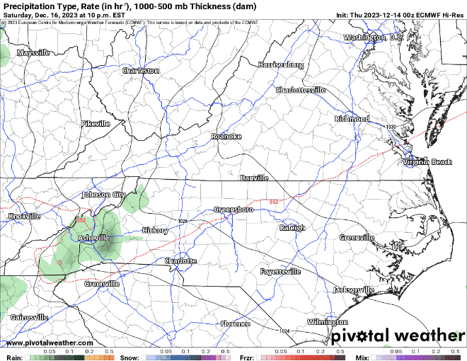
European Model Simulated Precip Courtesy of Pivotalweather.com
More Details Needed
You should begin preparing yourself for a high impact storm. With the amount of water predicted by several models, this system is going to cause problems all across WNC even if we don’t switch to snowfall. Our ground has been very dry and 2-3 inches of rainfall very quickly could create danger. This will be our first real threat for winter weather of the season so check back soon, ill have a video update here soon.


